 |
| Nicholas Macfarlane localizes whales in space and time with a new 3D stereo camera geocoding system |
 |
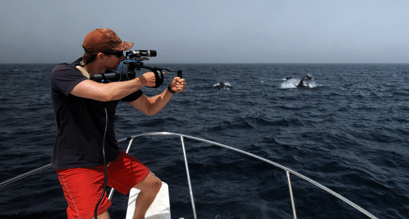
| The 3D geocoding system merges images from the left and right cameras to precisely position the animals. Examples of calculated inter-animal distances are shown on the left image |
Social animals like pilot whales often manifest many of their behavioral dynamics, such as reactions to stress or disturbance, through changes in their relative movement and position. Many social animals group more tightly together when they feel threatened.
Therefore, some of the key pieces of information that researchers try to collect are measures of group cohesion that capture these spatial changes.
But there's a problem: in practice, this is mostly done by eye and it's really hard to do in a quantitative way. Imagine that a group of whales surface for an instant before diving back down. Precisely estimating all the inter-animal distances in that moment is extremely difficult, particularly if the group is large and not right next to the boat.
Working with Jonathan Howland of WHOI's Deep Submergence Laboratory, we've developed a 3D geo-locating system designed to address this problem. It uses a GPS that tells you where you are and a 3D attitude sensor that tells you the direction you're looking. Then, just like your two eyes estimate depth perception, two cameras merge together to very accurately measure distance. All of the information is combined together by custom software to give us quick, easy and accurate positions of anything we can take a picture of.
Now we can use this system to precisely document detailed behavioral reactions to disturbances such as man-made noise or sonar.
---
Nicholas Macfarlane
No comments:
Post a Comment